Nederwiek wind farm zone
Specifics of the zone
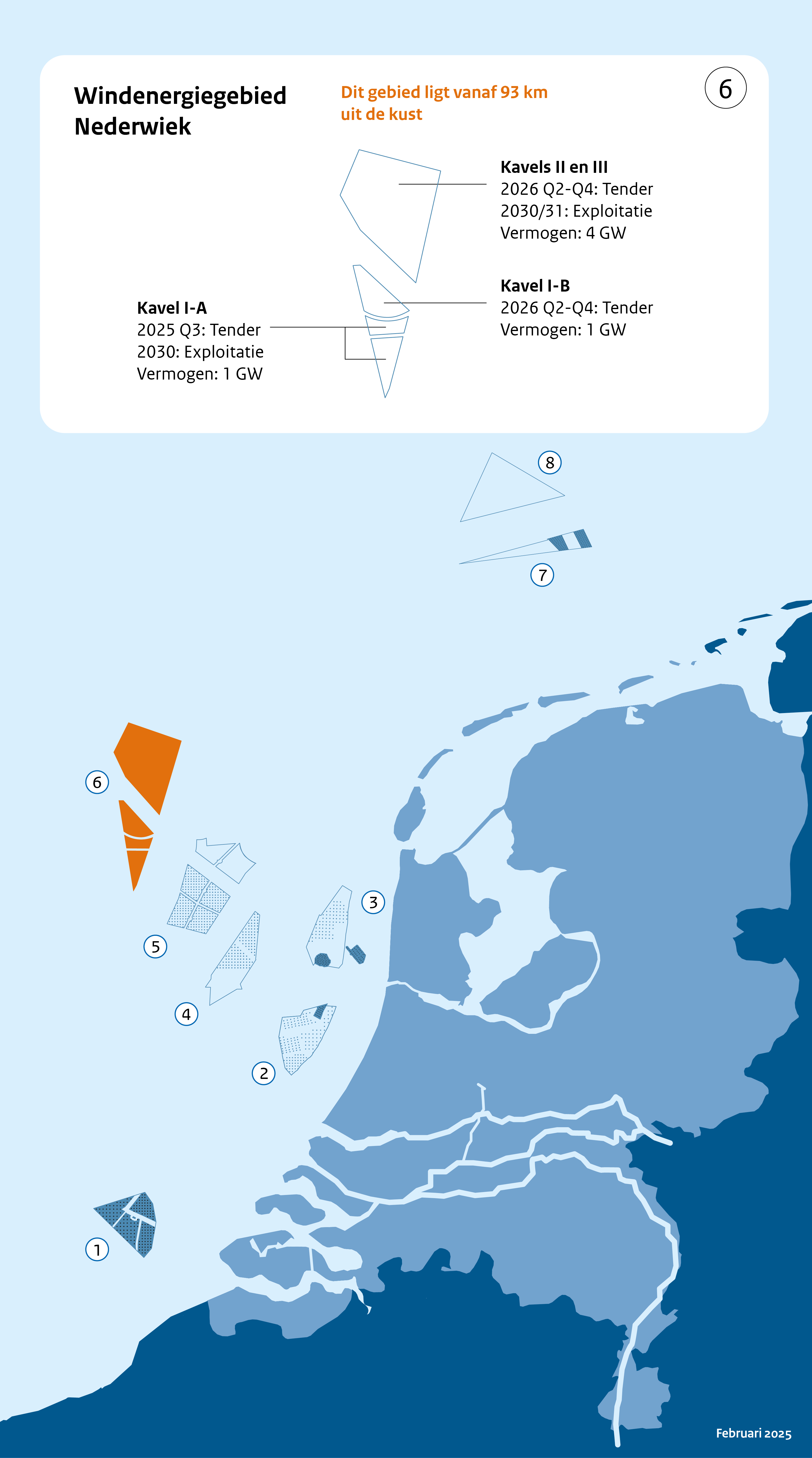
Nederwiek wind farm zone lies between 100 and 120 km from the coastline, to the north-west of IJmuiden Ver wind farm zone, bordering on the UK section of the North Sea. So it is a long way from the mainland and, on completion, will not be visible from the coast.
|
NEDERWIEK WIND FARM ZONE |
|
|
Location |
Northwest of IJmuiden Ver |
|
In use from |
2030 |
|
In use untill |
TBA |
|
Number of eind turbines |
TBA |
|
Turbine output (MW) |
TBA |
|
Wind farm output (MW) |
Approx. 6000 |
|
Surface area (km2) |
Approx. 600 |
|
Operators |
TBA |
Sites
You will be able to find information about site decisions and issuance of sites on the website of RVO Bureau energieprojecten.
Do you want to compete for the permit for construction and operation of a wind farm in the Nederwiek Wind Farm Zone Site I-A in the North Sea? See the website Permit for wind farm Nederwiek I-A | RVO.nl
Through shipping
A corridor runs through the wind farm zone to allow shipping, such as the IJmuiden - Newcastle ferry, to travel towards the United Kingdom. In the southernmost site (I-A), a space is kept free for shipping.
Shared use
An Area Passport guide will be available on the opening of the Nederwiek wind farm zone. Zoning in this area passport will show where there is space in the wind farm for shared use.